
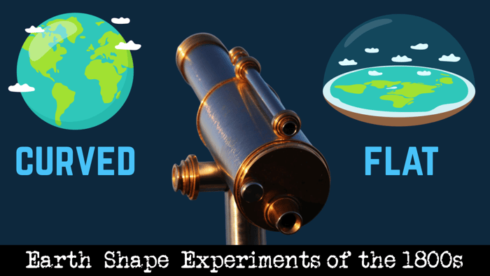
Let me start this article by stating that I don’t give a flying flip what shape the earth is; what I do greatly care about is being lied to. What I further care about is our hard-earned money being invested in the perpetual perpetration of lies. Let me further state, I have no way to confirm what shape the earth is. Why? Because NASA won’t show us real video footage or even real photography from space, NASA won’t bring any of us to space, worldwide governments have made it illegal to travel past the 60th South Parallel, we are only allowed to go to specific, predesignated tourist areas of Antarctica, and anyone who attempts to venture beyond these areas will be arrested or killed. Try and fly a drone into these areas, and the drone will be shot down, then you will be arrested. Not to mention, the Antarctic Treaty is the one thing that governments of the world oddly agree on. Strange, isn’t it?
That said, I came across this interesting book called Zetetic Astronomy: Earth Not a Globe, written in the 1800s by Samuel Burley Roebotham. Under the pseudonym Parallax, Mr. Roebotham performed experiments to prove the Earth is flat. What I found fascinating is how simplistic his experiments were - this is stuff anyone could do. Let me show some of them to you, and you can form your own opinion.
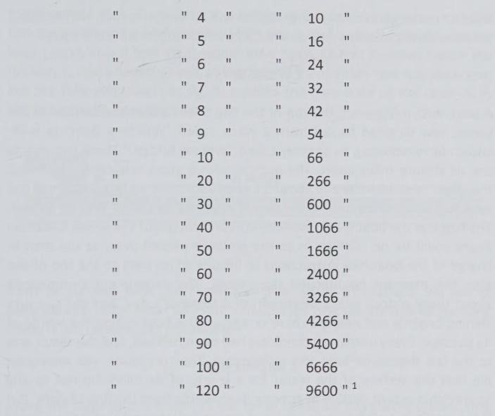
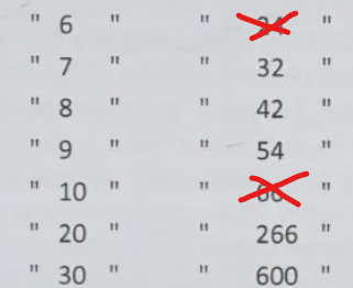
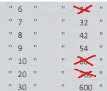
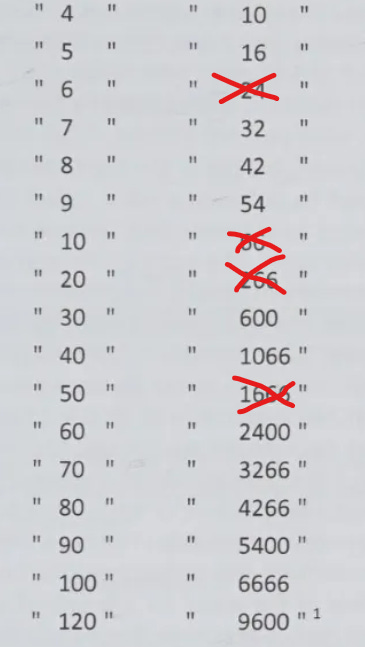
Parallax began the book by laying out curvature per statute mile. If you are not familiar with what this means, in order for the earth to be completely curved, with no points, each mile of land has to curve to some degree.

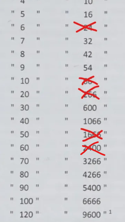
So, based on the size of the earth, the curvature in one statute mile is eight inches - this is a well-established “fact,” this is not something Mr. Roebotham decided upon. Three statute miles are six feet (1.8288 meters) of curve, 20 statute miles are 266 feet (81.0768 m) of curve, and so on. (If you’re wondering what exactly a “statute” mile is, it's a unit of linear measurement equal to 5,280 feet or 1,609.344 meters). Here is the curve-per-mile chart shown in the book:

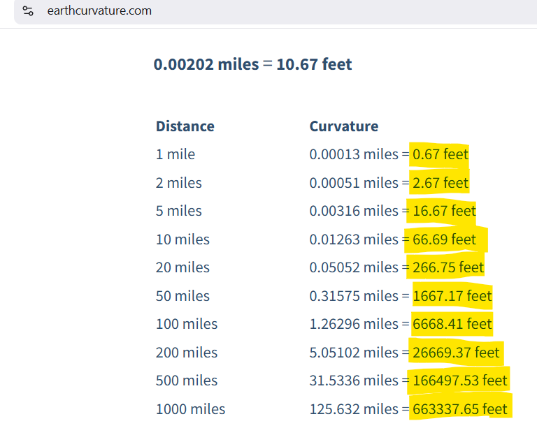
It might be easier visually to look at this chart from EarthCurvature.com:
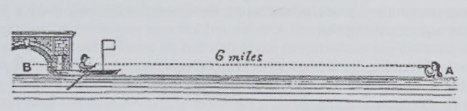
Let’s check out one of Roebotham’s, aka Parallax’s, experiments: This experiment was only six miles apart, which would mean there has to be 24 feet of curve in these six miles. Because there are 24 feet of curve, someone at point A should not be able to see someone at point B:
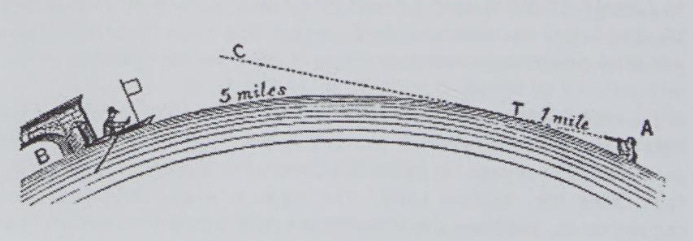
But the results of the experiment proved they could be seen in a straight line of sight without any curve between.
In the next experiment, Parallax took flags and spaced them out at equal heights for six miles. The hypothesis was that because of curvature, only the first flag would appear level, the second would appear lower, and the rest would begin to be greatly impacted by the curve of the earth, with the final flags being completely out of sight.
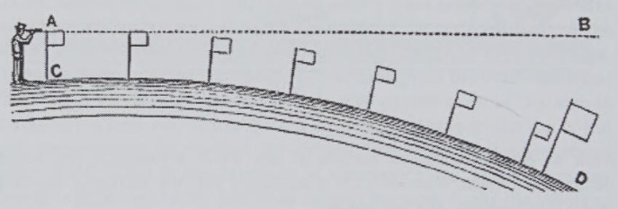
Result of the experiment:
A theodolite is a surveying instrument that measures angles between designated visible points as well as both horizontal and vertical planes:

Parallax obtained one, which probably looked like this:

Doesn’t everything from back then look so awesome, like art? This thing looks like it would last forever.
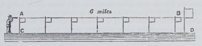
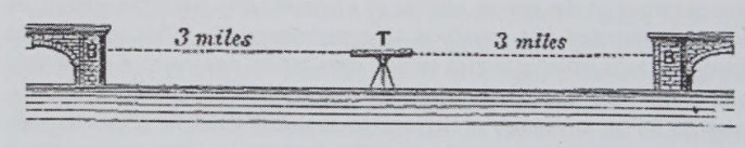
He put the theodolite directly between two points, with three miles on each side. The assumption was that, due to six feet of curve of the earth on each side, it would be impossible to see the buildings level from the center.
The result was a straight-on view of both points with three miles in between.
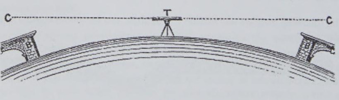
In another experiment, he stationed a ship exactly in the center of 10 miles between two points. Due to 66 feet of curvature, the ship should be elevated above structures on both sides....
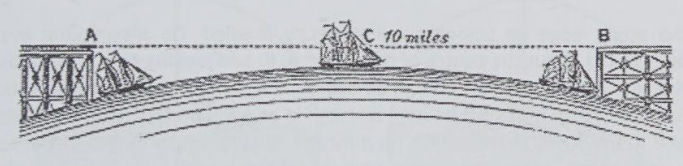
But this was not the case:
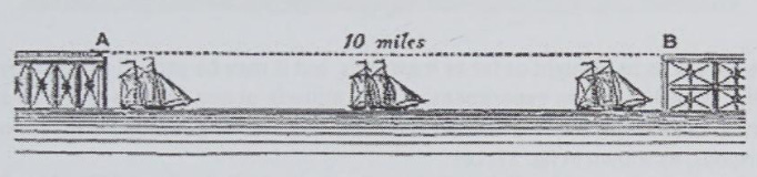
Back in the 1800s, Parallax proved that no curvature can be seen at short distances (10 miles and less):
Now it was time to run longer-distance experiments. For this, Parallax began with the Isle of Wight:
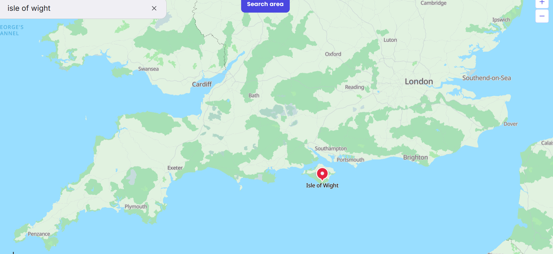
Parallax stood in Portsmouth Harbor, facing the Isle of Wight, which could be clearly seen from Portsmouth:
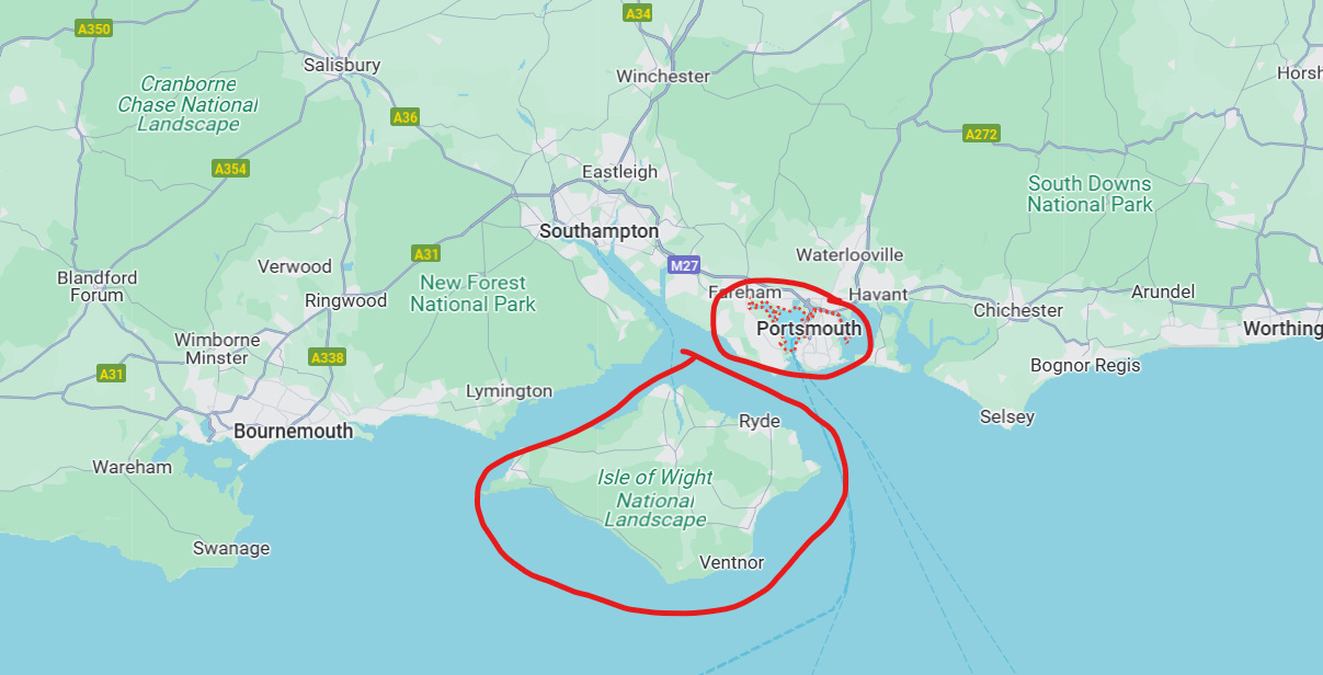
The Isle of Wight is a length of 22 statute miles, which would mean it would have to curve over 266 feet. When looking through a theodolite, it would have to look like this due to the curve of the earth:
However, when looking through the theodolite, the crosshairs showed the land and water perfectly horizontal.
There was absolutely no visible curve at 22 statute miles.
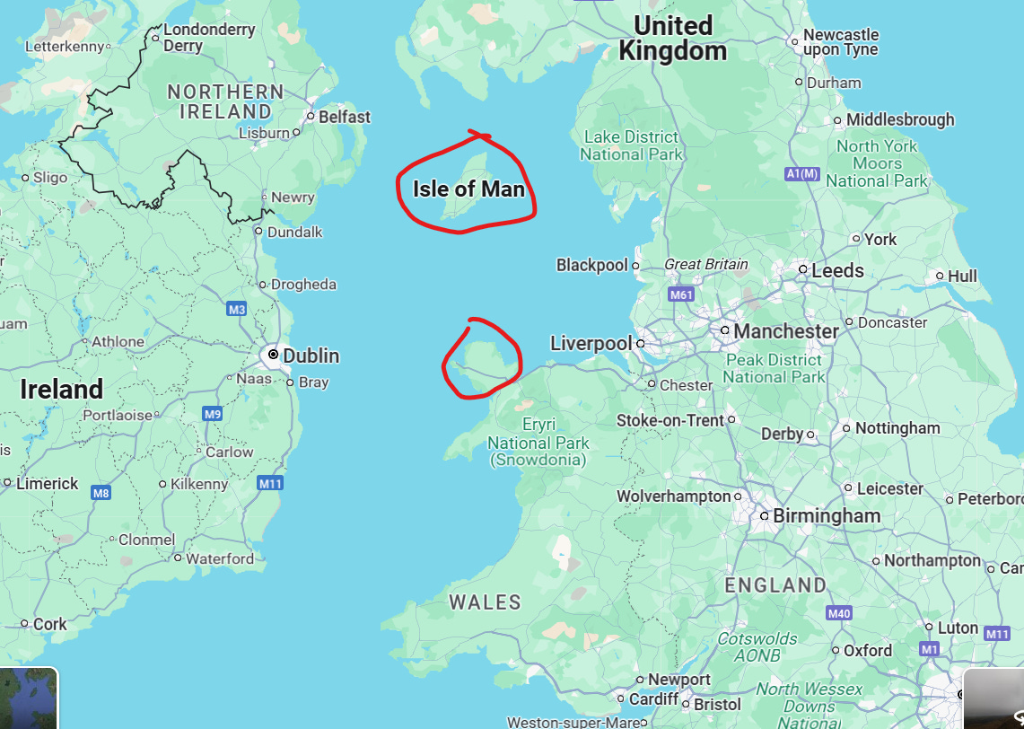
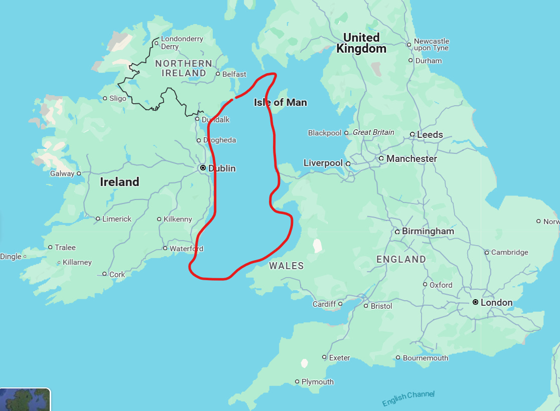
Next, from the Isle of Man, the whole length of the coast of North Wales can be seen, 50 statute miles away (I think this is the area he is referring to):
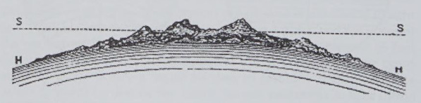
Based on the curvature of the earth (1,666 feet in this case), it should look like this:
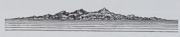
But it actually looked like this:
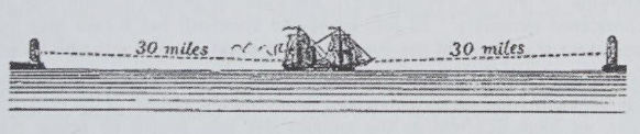
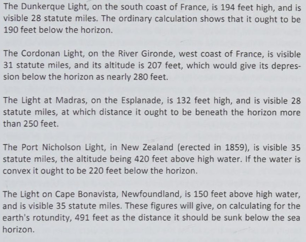
In a different study, people on ships could easily see lighthouses on either side of the water. However, this should not have been possible because there was a 30-mile distance between the people and the lighthouses. 30 miles would be over 600 feet of curve.
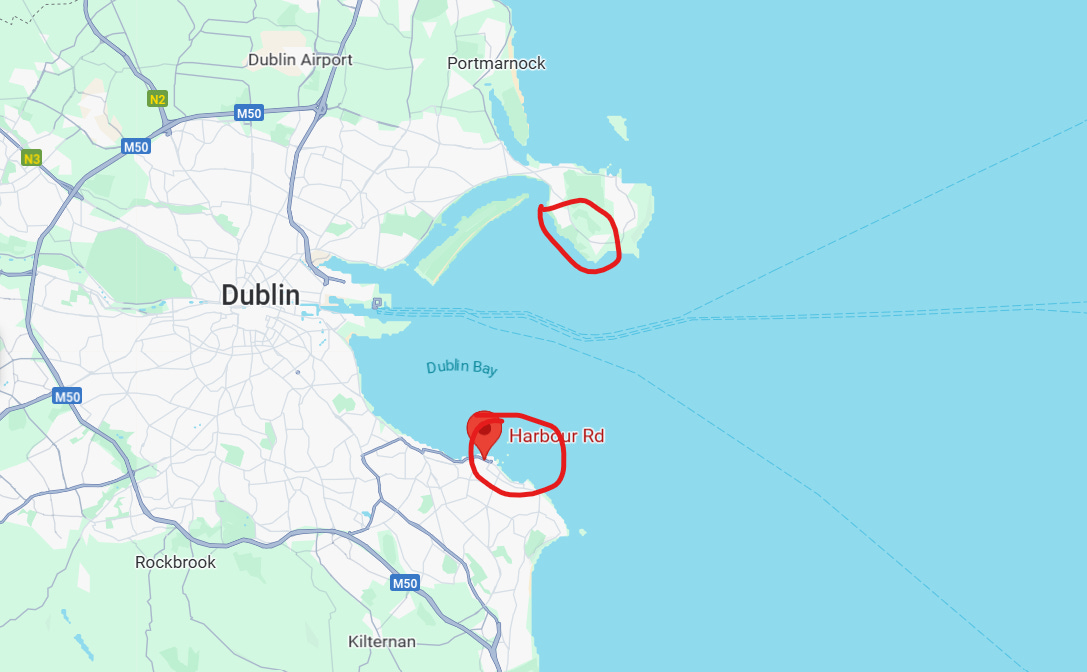
Another experiment involved St. George’s Channel, which I believe is here:
From the center of St. George's Channel (near Dublin) to Holyhead is at least 60 statute miles across.
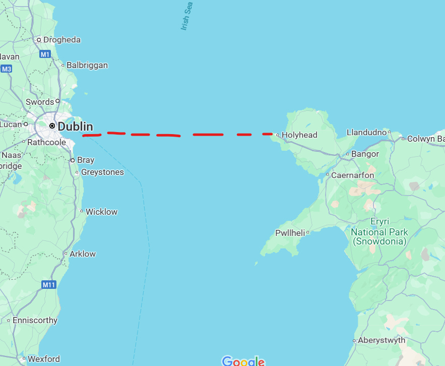
This would equal 2,400 miles of curve; however, from the center point, lighthouses can be seen in a straight line on both sides:
This was the case with all the areas he tested (there are far more than this in the book):
Another interesting thing included in his book is a letter that was sent during the Crimean War. The subject was gunnery in connection with the Earth's rotation. As Parallax says, this topic, quote, occupied the attention of many philosophers, as well as artillery officers and statesmen. The letter was written by Lord Palmerston, Prime Minister, to Lord Panmure, the Secretary for War, on December 20, 1857.
The letter says, "There is an investigation which would be important and at the same time easy to make, that is, whether the rotation of Earth on its axis has any effect on the curve of a cannonball in its flight. One should suppose it has, and that while the cannonball is flying in the air, impelled by the gunpowder in a straight line from the cannon's mouth, the ball would not be able to follow the rotation of the Earth in the same manner which it would do if it was lying at rest on the Earth's surface. If this be so, a ball fired in the meridional direction, that is to say due south or due north, ought to deviate to the west of the object at which it was aimed, because during the time of flight that object will have gone to the east somewhat faster than the cannonball will have done.”
“Like in manner, a ball fired due east ought to fly less far upon the Earth's surface than a ball fired due west, the charges being equal, the elevation the same, and the atmosphere perfectly still. It must be remembered, however, that the ball, even after it has left the cannon's mouth, will retain the motion from west to east which it had before received by the rotation of the Earth on whose surface it was, and it is possible, therefore, that, except at very long ranges, the deviations above mentioned may in practice turn out to be very small, and not deserving the attention of artillerymen. The trial might be easily made in any place in which a free circle of a mile or more radius could be obtained and a cannon placed in the center of the circle and fired alternately north, south, east, and west with equal charges.”
That was what I wanted to highlight from the book; now let’s look at some other interesting things:
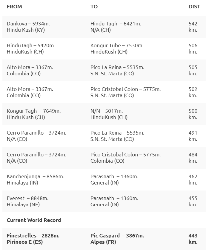
The furthest object ever photographed was Pic Gaspard, a mountain in the French Alps. The photo was taken from Pic de Finestrelles, a mountain in the Spanish Pyrenees, a distance of 269 miles (443 kilometers).
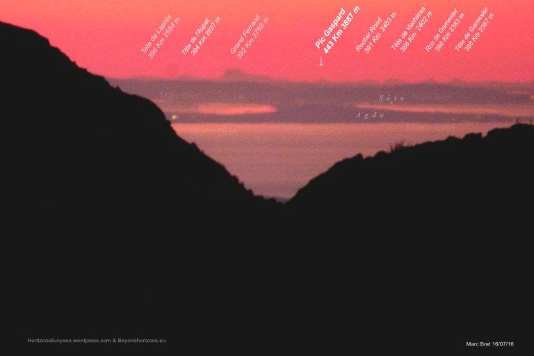
It is recognized by the Guinness Book of World Records as the longest line of sight on earth photographed.
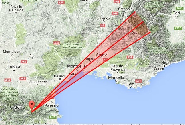
Although that is the world record, there are lots of other incredible lines of sight:
Of course none of this is possible on a globe-shaped earth model because the curvature is over 48,596 feet (almost 10 miles, which is 16 km.)
But, to make it possible, science explains that the light bends in a special way that allows us to see around curves. There is no way to know if the simplest explanation (the earth is flat) or if the scientific explanation is correct due to all the reasons I addressed at the beginning of this post. If NASA would just attach a continuous-record camera to one of their “rockets” and not cut the film a bunch of times as it ascends to “space,” we could easily settle this debate, but that won’t happen, so we are stuck. What I can tell you are a few facts that you can verify:
My buddy is in the civil engineering field. Among other things, his specific job is to determine how much weight from snow or rainwater something can hold, for example, a suspension bridge. He also has to determine the appropriate spacing for beams and such. At no point has he ever factored in curvature. Nothing about curvature has been mentioned in any of his studies.
Pilots are not taught anything about the curvature of the earth. Here is interesting testimony from a pilot:
If you are listening on audio, here is a transcription of the pilots testimony:
“In October of 2015, I was commanding a routine six-hour flight. When it came to initializing the IDARU, it returned an error. I called the tower, explained the situation, and they sent an avionics tech out.
In this situation, they would normally just unplug it and slide a replacement box in there. However, it’s a rare occurrence and has never happened to me. Unfortunately, there was no replacement available at this location.
I called the company and reported the situation. After about 20 minutes, someone got back to me and advised that they could get a replacement box to me, but would take about 12 hours. Or, since my flight plan was not outside of ground radar coverage, I could use GPS as a primary reference and adjust the IDARU’s data via ATC manually and periodically to compensate for drift.
I decided that the later suggestion was within safe limits and made the decision to continue. Throughout the entire flight, mine was a six-hour flight, no drift occurred. This was a real head-scratcher, and since its company policy and my personal policy to understand as much as possible about the aircraft and its systems, I wanted to know why.
I talked to someone at our fleet maintenance department and was told that they didn’t make repairs to any black boxes, and I should talk to the manufacturer. In this case, Honeywell. I contacted Honeywell and managed to talk to a senior IDARU engineer. He was very helpful. It turns out they don’t make the ACM, the lay alignment calibration module, which looks a bit like a desktop PC hard drive, painted bright orange with warnings printed on it, do not open, serviceable only by manufacturer. It turns out that there’s only one company that supplies these modules to all avionics makers, and nobody else seems to know anything about their workings.
I tried contacting the company and was just given the runaround.
[The podcast host then explains] The black box was made by Honeywell. The alignment calibration module is not made by Honeywell. It’s subcontracted out by another company, and that company has it sealed to where only they are allowed to work on it, but they don’t ever work on it. They just swap them out. So what happened was this particular alignment module broke before he could fly, so he flew the six hours without using it.
The plane should have drifted because of the curvature and the Coriolis effect, otherwise known as the spinning of the earth, and it didn’t. He discovered, well, this module is made by exactly one company, and they supply every airline in the industry. And when you try to call them, they don’t talk to you.” [end transcription]
Additionally, military ballistic missiles and other projectiles don’t factor in curve. The equipment “assumes a flat, stationary earth.” End transcription.
Communications towers and “satellites” shoot signals in straight lines.
Railway and roadway builders don’t factor in curve.
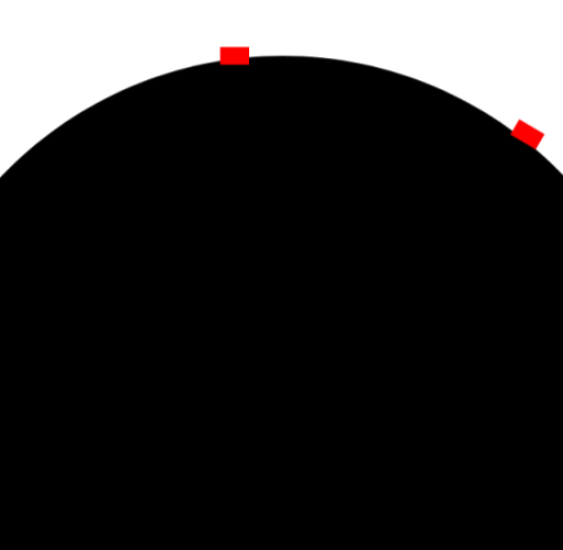
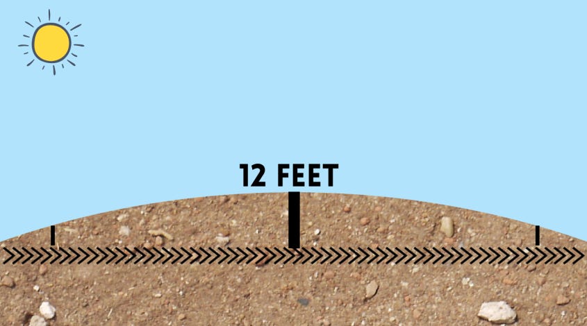
One of my readers who is in the commercial building business said he has never considered a curve, even when laying the foundation for a 1-or-more-mile-long warehouse, no curve is considered. For example, a building like the three-mile-long Prora…
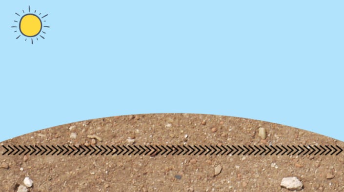
If you wish to lay a foundation on flat land, you would have to deal with the rise in the center and the lower elevation on the sides because the ground is a ball
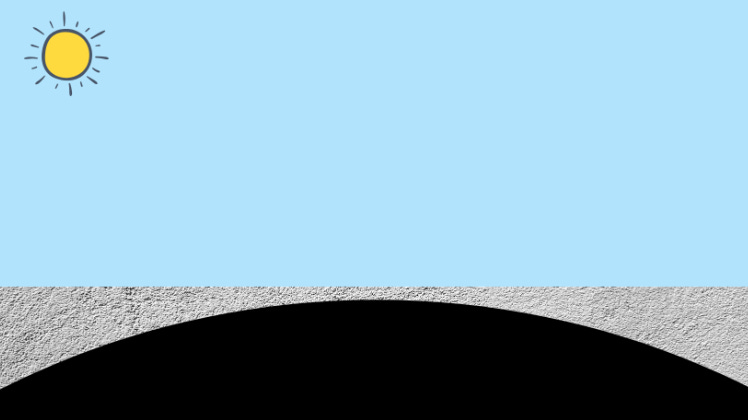
If you wish to dig out the area, you would have less digging to do around the edges and the most digging in the middle.
In fact, there would have to be 12 feet excavated to make the ground level. But heavy excavation would be only in the center area.
Anyway, I thought this was interesting enough to share. For people who believe Antarctica is not off-limits because cruise ships go there, select YouTubers have filmed there, and the Discovery Channel has documentaries on it, I encourage you to watch Antarctica: Sorry We’re Closed. I do want to state that I dislike when people degrade others for believing the shape of the earth is different than they believe. I think it’s mean, and it accomplishes nothing aside from division. I also think it is a stupid thing to argue over when none of us know, nor do we have the ability to find the answer because that ability has been taken from us. That said, the fact that the ability has been taken from us is pretty suspicious. Combine that with nothing but smoke, mirrors, and CGI coming from NASA, and we have ourselves a pretty sketchy situation.
If you start looking into how we determined the earth was a globe to begin with, you will discover that, for all of history, it was believed to be flat until the philosophers came along and decided it’s actually round. Mind you, nobody had been to space; there was no proof of this; it is just what they decided. Perhaps one day I will do a deep dive into this topic because it sure would be interesting.
I hope you loved this post! If you appreciate my research, please consider hooking me up with a coffee or making a Ko-Fi donation. These articles take a lot of time, and I do it for free because I love raising awareness, but the articles aren't actually free to write. There are surprisingly a lot of costs that go into being a journalist, and contributions REALLY help!


![The Satellite Hoax: The First Photo of Earth From Space, Propaganda & Johns Hopkins [Part 1]](https://dropinblog.net/cdn-cgi/image/fit=scale-down,format=auto,width=700/34264201/files/featured/satellite-part-1-1.jpg)

![FAKE AND GAY: The Pedophile Takeover of US Government - a scandalous true story [Part 1]](https://dropinblog.net/cdn-cgi/image/fit=scale-down,format=auto,width=700/34264201/files/featured/9f581d16-2ca3-452e-b8c9-3848784309ea-1400x788.webp)
![Murder, Mayhem, MK Ultra, Elites, Abortions & Spies: The Secret World of PLAYBOY [PART 4]](https://dropinblog.net/cdn-cgi/image/fit=scale-down,format=auto,width=700/34264201/files/featured/playboy-1.png)